We woke to a clear, cool morning. I ventured down the hill to the bike camp’s washroom, and spoke to a 60 something year old guy who was on his way from San Diego to South Carolina, pedaling all the way. He seemed not what I expected, as he spoke right wing politics, the virtue of Wal-Marts putting all the inefficient local businesses out of business, and the craziness of Obama’s health care plan. But here he was, 1/4 of the way on his cross country bike trip. Ya never know who you’ll meet. He also mentioned he’d been rousted out of his tent at 11 the last night, by a local sheriff who demanded to see his ID. She never made it up the hill to bother us, either we looked like part of the Forest service’s vehicles, or maybe it was too dark where we were. So we had an uneventful, quiet night. From the lot, we then went up the long incline of 191 west, and into the Black Hills, and then down the other side; second gear along the way at the steep parts…no trouble or hot brakes…phew. Just past the intersection with route 70, we took the small, but paved Haekel |Road heading south, and towards Hot Well Dunes BLM recreation Area.
We had heard of this area back in the desert, that had been designated an off road dune buggy site. There was cheap dry camping there, great dunes for four wheeling, and two free hot tubs, way back in, 25 miles off the highway. Since it was mid week, we thought we might enjoy two of the features without being harassed by the noise and smell of the third. When we finally made it, we discovered that it would have been a great place to have spent the night, and there had been several rigs parked here and there among the dunes. But even arriving early in the morning was a fine thing. We found only one of the two tubs was open, but it was the one set under a big shade tree, so we donned our suits (yes, this is still a public place) and settled in for a nice, relaxing hot spring soak. We were later joined by a teenager, who was here with his family for the four wheeling on the dunes, and later by another guy who was down from Colorado, and camping with a buddy at a place they come at least once a year. We learned that the second pool was closed because a BLM worker mistakenly closed the valve completely on the well, and the pressure cracked the pipe, so now there was only enough flow to maintain one of the two tubs. We also learned that the busy holiday weekend was approaching, and by tomorrow, the place would be packed with people racing over the dunes during the day, and partying and hot tubbing at night. Thankful we had seen it during a quiet time, and realizing again our timing was just off (we hit the blizzards perfectly on the way down the East Coast, both weeks of Spring Break in Texas, Spring Break the next week in New Mexico, and now Easter weekend in Arizona) we appreciated what we had, and spent several hours just relaxing and soakin’ in the heat. It was wonderful, and another place on the map to return to, at another time, when we could spend several weekdays, enjoying the desert when it was quiet.
On the way out, we took a different road that approached Safford from the south, and went past Roper Lake State Park. This dirt and sand road was called the Tanque Road, and although it cut a few miles off the distance, it added an extra hour off travel time. Part of this was due to the ruts and washboard in the dirt, and the constant cattle guards that required slowing way down (this is open range cattle country, and although the ranches are fenced, the roads aren’t gated. Cattle guards keep the cattle from just walking down the roads to greener pastures. They are basically iron rails, probably old train tracks, set parallel to each other, about 5 inches apart, perpendicular to the road, and over a shallow ditch. Cars and trucks can rattle over the 8 or ten rails, but the cattle aren’t clever enough to tip toe safely across). But most of the delay was caused by the spectacular show of Mexican Poppies, covering the desert floor. We had seen some of this in the hills coming out of the mountains the day before, but here, for over ten miles of road through the desert, as far as you could see, the ground was literally covered with a carpet of bright yellow poppies. The cactus were still there, doing their desert thing, but instead of sand between them it was all swaying yellow flowers. It was unbelievable…we just stopped several times and stared (and of course, took pictures). Later that day in the campground, we spoke to a family from Colorado who comes down here every spring, and they said it’s been years and years since there were flowers like these. The snows and winter rains that broke a ten year drought gave us this amazing spring sight, and maybe this was a balancing of the bad timing, in that we did get to see an amazing display that hadn’t been seen in years in this area.
We finally made it to the highway north, and we motored up 191 towards Safford. We pulled into Roper Lake State Park, and found they still had a few sites left open. We saw they also had a natural hot tub here, as part of the park, and when we found a quiet, almost shaded spot off to one edge of the campgrounds, we parked our trailer, then headed back to pay our dues. Donna still needed some low level recuperation time, and a spot by a lake, with birds all around, and a free hot tub a five minute walk away, seemed like just the ticket. Roper Lake is one of the many State Parks on the chopping block of the state’s budget cuts. It is a man made lake, built by a Mr. Roper, who spent all his life mining and making money. One day, he decided he had spent enough time drilling and blasting rocks, and he wanted to live by a lake. So he bought some land that had a number of springs on it, had a thirty acre pond excavated, and built a house on a bluff looking down over it. Stocked with fish, he enjoyed this life by the water for a while, until his original passion took hold again. He returned to mining, and turned the lake over to the state. It’s a beautiful facility, well used by all sorts of people. Along one side is a road leading to a fishing pier and a boat launch (electric or paddle only) and one larger picnic area. Along the other is first a large dry camping area, and a row of cute little cabins on the shore. Then come two different 25 site serviced campgrounds, with a peninsula that juts out into the lake that’s the home to a swimming area, a series of palms, several picnic pavilions, and a large great horned owl. Being one of the few constant bodies of water in the area, it’s also the home to thousands of birds. We had a road runner as a constant visitor, jumping up on the table to get an eye to eye look at us. There also were these amazing yellow breasted blackbirds. Sounding and acting like our familiar northern red winged blackbirds, these are definitely a flashy southern variety. We first were amazed when we saw six or seven brilliant yellow and black birds alight in a nearby tree. The camera came out to record this rare sighting. Little did we know, that flocks of them live down in the marshy bits, and at times that evening, the trees would literally covered with hundreds of them, with a few of their more subtle red winged cousins thrown in for a nice counterpoint. Add to this a natural hot tub, that’s gloriously empty early in the morning, and you have a wonderful place, used by fishermen and picnicking families, tent campers, tiny trailers, big rigs, and folks in cabins. They say that all the parks in Arizona cost 30 million dollars to operate, so they must shut some of them down to help balance the state budget. But an independent study showed that the parks bring in 230 million dollars in revenue, but somehow the folks in the government ignore this, and are shutting down parks here and there. So come July, they plan to lock the gate, board up the buildings, and keep a skeleton security crew on to keep folks out. What are they thinking with? It’s like the decisions years ago to eliminate all the unnecessary programs in our school systems, like Phys ed., and music, and art, and hot lunches. So now we are faced with an epidemic of unimaginative, TV addicted, overweight, unhealthy kids becoming the next burden on the health care system. A big headline in the papers yesterday revealed that 8 and nine year olds are on heart medicine, and high blood pressure pills, and are suffering from high cholesterol, and diabetes. Michele Obama has taken on this problem as her outside activity beyond raising her own two girls, and she is right in seeing this is an epidemic that is sweeping the land. Young and old, the US is a land of overweight, unhealthy people, eating poorly, and not getting enough exercise. So let’s also close down the state parks, cuz you wouldn’t want to provide a place where people can get outside, and swim in a lake, and walk in the hills, and look at the stars. Enough…..
We had a wonderful time here, and the one day stop turned into three. We met a man who Donna new from the Fiberglass RV forums, and people from Tucson, and from Colorado: from Phoenix, and from Wisconsin. Everyone was enjoying the park, and all it’s features. We went into town several times, the first to the Big O Tire service. When I was checking the brakes I discovered the ominous hex head of a sheet metal screw imbedded in the tread of the left front tire. Knowing I wanted to be at a shop before I messed with it, I headed into the recommended facility. Sure enough, when we pried the little devil out, the tire started going flat with a loud, steady hiss. But for fourteen dollars, I got a super plug/patch put in; had the brakes again checked with the wheel off, and things seemed fine; had a pulley squeak checked and confirmed as no problem until it got louder and grinding; and had a free car wash thrown in. Another trip provided similarly wonderful service in the local library, everything we could ask for and more. We also found a great Mexican Restaurant for lunch one afternoon, Mi Casita. So we slowed down, enjoyed the luxury of power, daybreak hot tubs, evening hot showers, with an interesting little town 15 minutes away. We had a lovely anniversary dinner at the campgrounds (26!!), a fresh bouquet of flowers on the table, a bottle of fine red wine with the meal, and a tub of Breyers all natural ice cream in the freezer. What more could one ask for? Thank you, thank you very much.
Friday, April 2, 2010


Tuesday, March 30, 2010
The Ups and Downs around Pietown
We woke the next morning, refreshed and feeling blessed. Stirring the ashes, I found enough coals to start another fire to help take the chill off the early morning. It was yet another below freezing night, with the furnace still not working, but it was great for sleeping snuggled under the covers. We had a leisurely breakfast, and a refreshing cool shower back in the bush, and were feeling ready for the day. The same ranger we met the night before stopped by, and we spent quite a while chatting with him. He was originally from New Jersey, and had just been assigned out here in New Mexico in January. When we mentioned the beautiful light during the “golden hour” last evening, he said he was kicking himself as he drove home, because he had forgotten his camera, and yes, it was an amazing evening for photos. He said that was his real passion, and he gave us his email, so we could link to his sites of photos. (jamescutillo@yahoo.com if anyone’s interested too) Eventually we got on our way, and aimed south down 117. On another trip we’ll stop and explore this park a bit more, as there are trails and caves and lava tubes miles long in the park, but for us, for today, it was time to aim towards Pietown. Yup, check it out, there on route 60 in western New Mexico, PIETOWN. Donna had read about it somewhere, so here it is on our places to see list.
117 turned to 36, then we hit 60 at Quemado, which was another sad little town in the high desert. Lots of closed businesses, run down houses, and a gas station/café that was still operating, but it looked more dependent on the locals, rather than drive by traffic. So we headed east towards the continental divide. Pietown was established in the late 1800’s, and because of its location, along a traveled route right at the top of the continental divide, it was always a favored resting and watering spot. You had made it to the top of a long long climb, and were about to head west, to where the water flows towards the Pacific instead of the Atlantic, and why not stop and take a break right here. A local merchant was a great baker, and became quite famous for his pies. Word spread, and folks just starting referring to the place as Pietown; and the name stuck. Today, you have your choice of visiting the Daily Pie, or the Pie-o-neer Café; or both, as we did. However, when we first arrived, singing our little Pietown song all the way (pietown…pietown…we are going to pietown), we pulled into the lot, and the Daily Pie was Closed…oh no. With tears in her eye, Donna wrote a little note lamenting our fates, and slid it under the locked door, relating how we had traveled all the way from eastern Canada, just for a piece of pie. The gods were smiling, as was the guy cleaning up, because he found our note, came out from the back, and called the cook back in. They opened up, and we left with a piece of peanut butter pie for Donna, and New Mexican Apple pie for me ( pinon nuts and chillies spice up the apple). My oh my, they were good. After devouring the first bites, then savouring the last, we left the parking lot and went a few hundred yards up the road to the Pie-o-neer. Another funky, down-home place, with wonderful décor, lots of local flavor, and a great veranda out front, we settled back in, first had a spinach cheese enchilada, and finished with a piece of sweet potato pie. Dixie was able to join us on the porch, and we all had a grand time. There was a free town camp ground across the street, but a local who was chatting with us from an adjacent rocker, said we should go on down to the BLM campground at Datil Well; it was shadier, and nicer, and more importantly, a thousand feet lower in altitude, so warmer too. So with a freshly filled water jug from the Pie-o-neer’s tap (good water too) we said goodbye to Pietown, and headed on east, down the mountain.
The countryside was beautiful here, long ridges and hills, covered with glorious Ponderosa Pines. They are truly majestic trees, and after days and weeks in the scrubbier forests, and mesquite and cactus covered desert, to be on this side of the mountain, and among the taller trees, was a fine thing. We pulled into the BLM park, and stopped at the host’s station. There were lots of sites available, dry camping only, for $5 a night, a real bargain. We drove the loop twice, and found the perfect spot. When we went back to confirm our location, we told him how lovely the grounds were, and about the recommendation from a Pietown local. Oh he laughed, that must have been Edna…silver Toyota pickup truck, Right? Yup, I laughed back, small town here isn’t it. He said that’s why he liked it here. He was from California, and although he lived miles from his nearest neighbor north of Joshua Tree, the bureaucracy and regulations to do anything back there in California had driven him away. Out here, his medical was covered because he was a veteran, and he and his wife were slowly building a new home nearby. They had been hosting here for four years, and just loved it. He’s fighting a battle with a new administrator who wants to come in and change the park around to make it more big rig friendly, but he hopes things stay as they are. After several nites there ourselves, we totally agree. There are sites for Big Rigs at one end, but up at the end where we were, the lanes were smaller, and not as level, and things were more conducive to small trailers and tenters, and quieter, non generator folks.
After settling in, and levelling out as best as possible, I took the dawg for a long walk on one of the trails back into the nearby hills. The trails had been built by a group of Junior conservation corps members, and it was lovely. It wound back into a fairly unique little area, where the mountains and hills, and wind and rain patterns, created a number of different areas that supported an interesting collection of different trees and species of plants and animals. On the walk, I saw four different juniper: one-seed, alligator, Arizona, and Utah; three types of oaks, and four different pines. And although there were no stunning views, or dramatic features, the whole area was just pretty, and gentle, and peaceful, and a wonderful place to stroll and be. That night we celebrated a bit with a bottle of wine with dinner, and the since it was cold, fired up the buddy heater during the night. And Donna woke up with a vicious headache and queasy feeling the next morning. Thinking she maybe needed some exercise and fresh air, she ventured off on the walk up the hills herself. Seemed like a good idea, but it was not.
The best we could figure out was that Donna had altitude sickness, because the added effort of taking that hike almost did her in. She came back literally green and staggering, and probably sicker than I have seen her in years. It was like very bad sea sickness…any movement, any noises, made things worse. Maybe add a nasty migraine to the seasickness, and you might be close to what she was going through. I’m sure the wine and heater the night before didn’t help, but the perfect storm of conditions made for one sick puppy, as they say. Calls around gave us more information, but liquids, time, and lower altitudes seemed to be the antidotes. We met some nice folks in another site, who gave us some advice and sympathy about Donna’s condition, and also some new information about the furnace. Spurred on by his insights, both about a pilot adjustment screw, and the “just tinker with it” attitude, I took the forced down time to take the furnace apart again, re rig the thermopile, and readjust the pilot. By mid afternoon, Donna was feeling a little better, and we had a furnace that was working again. Hooray, and hooray again. We eased into the evening, Dawg and I walking some more, Donna gently returning to life, and we had another quiet night, with our furnace adding the little heat we wanted. We also learned more about the area. Datil Well was one of fifteen wells along the 135 mile Hoof Highway. From Springerville Arizona to the railhead at Magdalena N.M., a well was established every ten miles, as a place where cattle could be watered and rested on the drive to market. In the busiest year, 1919; 21,677 head of cattle, and 150,000 sheep stopped and rested here, accompanied by the cowboys, sheepherders, chuck wagons, and saddle horses. Descendents of some of the drivers tell stories of this well, and how the local Apaches didn’t take kindly to the interlopers, and at night would stay up on the ridge, and send pot shots of arrows down into the camps. Local wisdom was to make sure you had a big tree between you and the ridge when you were picking your place to unstrap your bedroll. We didn’t see any flying arrows, but we did enjoy several moonlit nights near Datil well.
Feeling better the next day, and seeking lower climes, we followed route 12 south and west from Datil. The road took us back up into the Apache National Forest, and over and into the Tullarosa and Mogollon Mountains, but we had few choices, and as long as Donna was a sedentary passenger, she seemed to be all right. We went through Old Horse Springs, and Apache Creek, and Aragon, and Cruzville, and saw little towns that were never dependent on motor traffic, so they were puttering away, still tiny and still alive. Up near the San Francisco River, we ventured up a couple of long windy dirt roads towards potential campgrounds in the National Forest. We didn’t need a place, but wanted to explore for future reference. On one road, we only went halfway to the listed dry campground, but still found a peaceful and gorgeous part of the forest, where one could while away hours and days, listening to the call of birds, and wind in the pines. Farther down the road, we stopped at a place called The Catwalk. In 1889, rich gold and silver ore was discovered near here, and as happens, soon several mines and a town were established. Needing water for the 200 townspeople, and to operate the processing mills for the ore, a series of elaborate pipes were suspended along the canyon walls from 3 miles up in the mountains. In 1897, an 18 inch pipe was installed, and this operated the mill until 1913, when the ore supply diminished. Mining continued until 1942, but in the 30’s, the CCC built a suspended trail along the route of the pipelines, up into this beautiful Whitewater Canyon. In 1960, the National Forest people replaced the wooden platforms with the current steel ones, and now you can still take these suspended catwalks up into the canyon, at times fifty feet or more above the river and canyon bed below. It was a hot afternoon, Donna was in no shape for a walk, but Dixie and I ventured up the first section of path towards the catwalk. We finally made it, and then had a choice of going up the canyon on the catwalk, or crossing the canyon on a narrow bridge and joining another path heading back down. Dixie has never been one for bridges, and hates those open metal grate walkways, no matter what they go over. So put those two together, and then hang it all fifty feet up in the air, and she looked at me with a “Are you kidding me?” look. Realizing that a CATwalk was no place for a Dawg, we opted for the short bridge, and walk back down. At the base, we found Donna cooling her feet in the mountain waters, and we happily joined her. Again, another trip, another time for the catwalk.
From there we soon found 78 west, that took us past Mule Creek, and into Arizona. The road to Mule Creek was glorious, and wound ever higher. Again, we stopped at several BLM camp spots up in the Apache National Forest, that would have made wonderful stopping places for the night, but we decided it was probably best to continue down to lower ground near Safford and Thatcher, or maybe even make it to Hot Well Dunes. Probably was the key word. The road was wonderful to behold, and the views down onto the lower desert were magnificent. This year had the most rain and snow in the last ten, so the hills were just covered in brilliant orange centered, yellow California Poppies. Several times we just had to stop and marvel at the hillsides covered in yellow flowers. But in spite of the many stops, the hill was still too long and steep for our brakes. Burning out the brakes, or downshifting and burning out the transmission seemed to be my choices, so I opted for the brakes. By the time we hit bottom, they were hot, hot hot and smelling bad. The left front started to seize, so we pulled off the road, and sat for a bit. A local diving by said there was a gas station down the road at the intersection, so flashers on, we slowly made it to town. The gas station was just a pump, the town just a convenience store, but we met a friendly lady and her two daughters, who said, my husband’s a mechanic, so follow us home, and he can check things out for you. We did, and he did, and beer in hands, he and a buddy said things seemed fine, just next time, use your transmission, and just ease on down the hill real slow. We thanked them all, decided not to accept their imvitatiom to stay the night at their place, which seemed to be the local trailer community center, kids on trampolines, good ol boys drinking brews getting ready to roll some huge bails of hay off back at their tiny cattle yard, in general, a happenin’ place. We wenty back to the gas pump, found it closed, so headed 10 miles into Clifton, the next closest place with gas. Clifton also has one of the largest copper mines in the world, and it was obvious. The locals are proud of the monster, but it was all pretty hideous and overwhelming, even the small corner of it we saw. But after we found the station, we saw across the main drag, another small street, and the tops of some interesting buildings. We searched, and eventually found the road back into this now almost completely deserted, once thriving main street of the original town, Chase Creek. As the sun was setting, we rolled down the center of the street at 2 miles per hour, Donna snapping photos of the now empty buildings. In the fifteen minute tour, one car passed us; although 40 feet away, on the other side of the highway divider, a steady stream of traffic went on its modern day business. Eventually, we ran out of light and time, and aimed back to the intersection our latest adventures seemed centered around. There was the regional headquarters for the National Forest there, and a little camping spot for the bicyclists who take this well publicized bike route up into the mountains. We opted for the quieter parking lot up the hill, found a dark corner, and settled in for the night. It wasn’t our first choice, and the idyllic spots back up in the forest on the mountain taunted us from above. But we were stopped, and Donna was feeling physically better, if not spiritually happy. We were in a spot that was definitely not wonderful, or our first or second or even fifth choice, but it was safe and dark, and free. Good night, we‘ll see what the morning brings.
117 turned to 36, then we hit 60 at Quemado, which was another sad little town in the high desert. Lots of closed businesses, run down houses, and a gas station/café that was still operating, but it looked more dependent on the locals, rather than drive by traffic. So we headed east towards the continental divide. Pietown was established in the late 1800’s, and because of its location, along a traveled route right at the top of the continental divide, it was always a favored resting and watering spot. You had made it to the top of a long long climb, and were about to head west, to where the water flows towards the Pacific instead of the Atlantic, and why not stop and take a break right here. A local merchant was a great baker, and became quite famous for his pies. Word spread, and folks just starting referring to the place as Pietown; and the name stuck. Today, you have your choice of visiting the Daily Pie, or the Pie-o-neer Café; or both, as we did. However, when we first arrived, singing our little Pietown song all the way (pietown…pietown…we are going to pietown), we pulled into the lot, and the Daily Pie was Closed…oh no. With tears in her eye, Donna wrote a little note lamenting our fates, and slid it under the locked door, relating how we had traveled all the way from eastern Canada, just for a piece of pie. The gods were smiling, as was the guy cleaning up, because he found our note, came out from the back, and called the cook back in. They opened up, and we left with a piece of peanut butter pie for Donna, and New Mexican Apple pie for me ( pinon nuts and chillies spice up the apple). My oh my, they were good. After devouring the first bites, then savouring the last, we left the parking lot and went a few hundred yards up the road to the Pie-o-neer. Another funky, down-home place, with wonderful décor, lots of local flavor, and a great veranda out front, we settled back in, first had a spinach cheese enchilada, and finished with a piece of sweet potato pie. Dixie was able to join us on the porch, and we all had a grand time. There was a free town camp ground across the street, but a local who was chatting with us from an adjacent rocker, said we should go on down to the BLM campground at Datil Well; it was shadier, and nicer, and more importantly, a thousand feet lower in altitude, so warmer too. So with a freshly filled water jug from the Pie-o-neer’s tap (good water too) we said goodbye to Pietown, and headed on east, down the mountain.
The countryside was beautiful here, long ridges and hills, covered with glorious Ponderosa Pines. They are truly majestic trees, and after days and weeks in the scrubbier forests, and mesquite and cactus covered desert, to be on this side of the mountain, and among the taller trees, was a fine thing. We pulled into the BLM park, and stopped at the host’s station. There were lots of sites available, dry camping only, for $5 a night, a real bargain. We drove the loop twice, and found the perfect spot. When we went back to confirm our location, we told him how lovely the grounds were, and about the recommendation from a Pietown local. Oh he laughed, that must have been Edna…silver Toyota pickup truck, Right? Yup, I laughed back, small town here isn’t it. He said that’s why he liked it here. He was from California, and although he lived miles from his nearest neighbor north of Joshua Tree, the bureaucracy and regulations to do anything back there in California had driven him away. Out here, his medical was covered because he was a veteran, and he and his wife were slowly building a new home nearby. They had been hosting here for four years, and just loved it. He’s fighting a battle with a new administrator who wants to come in and change the park around to make it more big rig friendly, but he hopes things stay as they are. After several nites there ourselves, we totally agree. There are sites for Big Rigs at one end, but up at the end where we were, the lanes were smaller, and not as level, and things were more conducive to small trailers and tenters, and quieter, non generator folks.
After settling in, and levelling out as best as possible, I took the dawg for a long walk on one of the trails back into the nearby hills. The trails had been built by a group of Junior conservation corps members, and it was lovely. It wound back into a fairly unique little area, where the mountains and hills, and wind and rain patterns, created a number of different areas that supported an interesting collection of different trees and species of plants and animals. On the walk, I saw four different juniper: one-seed, alligator, Arizona, and Utah; three types of oaks, and four different pines. And although there were no stunning views, or dramatic features, the whole area was just pretty, and gentle, and peaceful, and a wonderful place to stroll and be. That night we celebrated a bit with a bottle of wine with dinner, and the since it was cold, fired up the buddy heater during the night. And Donna woke up with a vicious headache and queasy feeling the next morning. Thinking she maybe needed some exercise and fresh air, she ventured off on the walk up the hills herself. Seemed like a good idea, but it was not.
The best we could figure out was that Donna had altitude sickness, because the added effort of taking that hike almost did her in. She came back literally green and staggering, and probably sicker than I have seen her in years. It was like very bad sea sickness…any movement, any noises, made things worse. Maybe add a nasty migraine to the seasickness, and you might be close to what she was going through. I’m sure the wine and heater the night before didn’t help, but the perfect storm of conditions made for one sick puppy, as they say. Calls around gave us more information, but liquids, time, and lower altitudes seemed to be the antidotes. We met some nice folks in another site, who gave us some advice and sympathy about Donna’s condition, and also some new information about the furnace. Spurred on by his insights, both about a pilot adjustment screw, and the “just tinker with it” attitude, I took the forced down time to take the furnace apart again, re rig the thermopile, and readjust the pilot. By mid afternoon, Donna was feeling a little better, and we had a furnace that was working again. Hooray, and hooray again. We eased into the evening, Dawg and I walking some more, Donna gently returning to life, and we had another quiet night, with our furnace adding the little heat we wanted. We also learned more about the area. Datil Well was one of fifteen wells along the 135 mile Hoof Highway. From Springerville Arizona to the railhead at Magdalena N.M., a well was established every ten miles, as a place where cattle could be watered and rested on the drive to market. In the busiest year, 1919; 21,677 head of cattle, and 150,000 sheep stopped and rested here, accompanied by the cowboys, sheepherders, chuck wagons, and saddle horses. Descendents of some of the drivers tell stories of this well, and how the local Apaches didn’t take kindly to the interlopers, and at night would stay up on the ridge, and send pot shots of arrows down into the camps. Local wisdom was to make sure you had a big tree between you and the ridge when you were picking your place to unstrap your bedroll. We didn’t see any flying arrows, but we did enjoy several moonlit nights near Datil well.
Feeling better the next day, and seeking lower climes, we followed route 12 south and west from Datil. The road took us back up into the Apache National Forest, and over and into the Tullarosa and Mogollon Mountains, but we had few choices, and as long as Donna was a sedentary passenger, she seemed to be all right. We went through Old Horse Springs, and Apache Creek, and Aragon, and Cruzville, and saw little towns that were never dependent on motor traffic, so they were puttering away, still tiny and still alive. Up near the San Francisco River, we ventured up a couple of long windy dirt roads towards potential campgrounds in the National Forest. We didn’t need a place, but wanted to explore for future reference. On one road, we only went halfway to the listed dry campground, but still found a peaceful and gorgeous part of the forest, where one could while away hours and days, listening to the call of birds, and wind in the pines. Farther down the road, we stopped at a place called The Catwalk. In 1889, rich gold and silver ore was discovered near here, and as happens, soon several mines and a town were established. Needing water for the 200 townspeople, and to operate the processing mills for the ore, a series of elaborate pipes were suspended along the canyon walls from 3 miles up in the mountains. In 1897, an 18 inch pipe was installed, and this operated the mill until 1913, when the ore supply diminished. Mining continued until 1942, but in the 30’s, the CCC built a suspended trail along the route of the pipelines, up into this beautiful Whitewater Canyon. In 1960, the National Forest people replaced the wooden platforms with the current steel ones, and now you can still take these suspended catwalks up into the canyon, at times fifty feet or more above the river and canyon bed below. It was a hot afternoon, Donna was in no shape for a walk, but Dixie and I ventured up the first section of path towards the catwalk. We finally made it, and then had a choice of going up the canyon on the catwalk, or crossing the canyon on a narrow bridge and joining another path heading back down. Dixie has never been one for bridges, and hates those open metal grate walkways, no matter what they go over. So put those two together, and then hang it all fifty feet up in the air, and she looked at me with a “Are you kidding me?” look. Realizing that a CATwalk was no place for a Dawg, we opted for the short bridge, and walk back down. At the base, we found Donna cooling her feet in the mountain waters, and we happily joined her. Again, another trip, another time for the catwalk.
From there we soon found 78 west, that took us past Mule Creek, and into Arizona. The road to Mule Creek was glorious, and wound ever higher. Again, we stopped at several BLM camp spots up in the Apache National Forest, that would have made wonderful stopping places for the night, but we decided it was probably best to continue down to lower ground near Safford and Thatcher, or maybe even make it to Hot Well Dunes. Probably was the key word. The road was wonderful to behold, and the views down onto the lower desert were magnificent. This year had the most rain and snow in the last ten, so the hills were just covered in brilliant orange centered, yellow California Poppies. Several times we just had to stop and marvel at the hillsides covered in yellow flowers. But in spite of the many stops, the hill was still too long and steep for our brakes. Burning out the brakes, or downshifting and burning out the transmission seemed to be my choices, so I opted for the brakes. By the time we hit bottom, they were hot, hot hot and smelling bad. The left front started to seize, so we pulled off the road, and sat for a bit. A local diving by said there was a gas station down the road at the intersection, so flashers on, we slowly made it to town. The gas station was just a pump, the town just a convenience store, but we met a friendly lady and her two daughters, who said, my husband’s a mechanic, so follow us home, and he can check things out for you. We did, and he did, and beer in hands, he and a buddy said things seemed fine, just next time, use your transmission, and just ease on down the hill real slow. We thanked them all, decided not to accept their imvitatiom to stay the night at their place, which seemed to be the local trailer community center, kids on trampolines, good ol boys drinking brews getting ready to roll some huge bails of hay off back at their tiny cattle yard, in general, a happenin’ place. We wenty back to the gas pump, found it closed, so headed 10 miles into Clifton, the next closest place with gas. Clifton also has one of the largest copper mines in the world, and it was obvious. The locals are proud of the monster, but it was all pretty hideous and overwhelming, even the small corner of it we saw. But after we found the station, we saw across the main drag, another small street, and the tops of some interesting buildings. We searched, and eventually found the road back into this now almost completely deserted, once thriving main street of the original town, Chase Creek. As the sun was setting, we rolled down the center of the street at 2 miles per hour, Donna snapping photos of the now empty buildings. In the fifteen minute tour, one car passed us; although 40 feet away, on the other side of the highway divider, a steady stream of traffic went on its modern day business. Eventually, we ran out of light and time, and aimed back to the intersection our latest adventures seemed centered around. There was the regional headquarters for the National Forest there, and a little camping spot for the bicyclists who take this well publicized bike route up into the mountains. We opted for the quieter parking lot up the hill, found a dark corner, and settled in for the night. It wasn’t our first choice, and the idyllic spots back up in the forest on the mountain taunted us from above. But we were stopped, and Donna was feeling physically better, if not spiritually happy. We were in a spot that was definitely not wonderful, or our first or second or even fifth choice, but it was safe and dark, and free. Good night, we‘ll see what the morning brings.


Saturday, March 27, 2010
Demonic Drivers and the Enchanted Mesa
The next morning, we woke up early, and I told Donna everything Mary had told me the night before. Sharing my excitement and interest, we decided to pack up as quickly as possible, and venture down to the dig south of town. As we finished breakfast and then the dishes, we watched all the Big Rigs, that filled the campground the night before, make a slow parade by us as they all stopped at the Dump Station, lightening their loads before they caravanned to their next stop on their group‘s itinerary. It’s somewhat perplexing to us to see all these people, in their fully equipped homes on wheels, moving from place to place as a group, so they can park near each other, say good night to the same neighbors, before they go inside and watch their same television shows, every night in a different place. But I guess they look at us, and how we travel, and think we’re the crazy ones. As we left the now empty park, the wind was already starting to pick up. By the time we made it through Carrizozo, and down to the site, it was really starting to blow. But there was Mary and her coworkers, shovelling and whisking and sifting and bagging, the last morning’s bits of discoveries. Mary took the time to give us a tour of the areas they were working on now, and again you could feel her excitement and joy in what they were doing and finding. It was fascinating to see what had been unearthed, and the painstaking work that was involved to slowly reveal the mysteries that had been buried so many hundreds of years ago. And there they were, fifteen feet off the shoulder of the road, as trucks and cars whizzed by, pondering the remains of a people’s lives from a millennium ago. It was all pretty amazing.
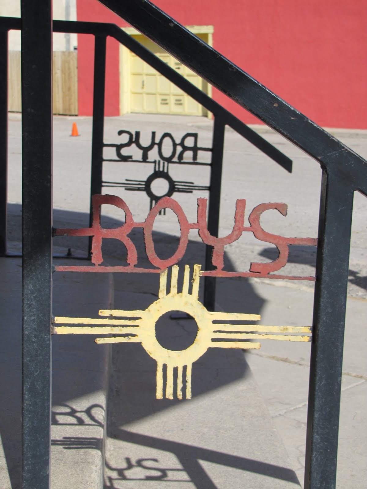
Knowing they had work to finish, and we had miles to travel, we got back in Bucko and prepared to climb back up the embankment onto the highway. In our excitement, we had plunged down to their site, following the tracks they had taken in their pick-ups, momentarily forgetting we were pulling a trailer, until we glanced back and saw the Buug at almost a 45 degree angle teetering along behind us. Realizing we had to attack the escape route at a different angle, Donna climbed the embankment, checked for traffic, then waved me on. Throwing sand with all four wheels, we charged up the hill and safely made it back to hard pavement. Realizing we had just barely avoided a foolish catastrophe, we eased back into Carrizozo, and decided to survey the old town main street, and wait for Roy’s Old Fashioned Ice Cream Parlour to open for the day. Donna had a great time photographing the old buildings (now painted wonderfully bright colors), the “art burros” peaking out from roof tops and alleyways, and signage and plants and whatever else struck her fancy. We learned that the town’s curious paint job was a recent addition to the buildings’ facades, as the movie “The Book of Eli,” had filmed here, and as part of the location agreement, they town had been repainted in these new, vibrant colors. Thank you Hollywood.
At 11:00, we ventured into Roy’s, and had another time shift, going back only thirty years this time. Two old-timers sat at little tables in the middle of what had once been a large, well stocked, early twentieth century pharmacy. 60 years ago, a soda fountain had been added, and then updated a few times since, but it still had the same wood and stainless fronts and coolers, the soda fountains, the old milk shake mixers, the mirror and clock from a time long past.. Way at the back, an old gentleman worked behind the counter, and I asked, are you Roy? Yup, that’s still me. Good I said, we were just thinking, it’s never too early for ice cream. Yup, I’d say you’re right, he answered, and slowly made his way up towards the fountain area. We then plunged into a long conversation, with Donna taking the lead (surprise, surprise), and we learned all about the town, and the history of the building. At one time, the town’s hospital had been on the second floor, and many local residents had been born upstairs, delivered by the doctor who built and ran the operation. The far wall had rows and rows of cabinets above, with drawers below, all with ceramic pulls labelling the products inside. In 1934, the good doctor retired, and others took over the pharmacy, and added the soda parlour. Roy retired from away, and moved back home to Carrizozo, and bought the building in the mid seventies. Since then , he has been selling ice cream and gifts, and newspapers and coffee to the locals, not changing much at all. Donna went for a banana milk shake, then made it a malt, and finally added a bit of chocolate to finish her customized cold lunch. I went for a good ol’ chocolate shake, and then too made it a malt with the addition of malt powder, and another whirr of the blender. We all agreed that a malted milk shake was a fine thing, that was going the way of the dodo. Quite a while later, we made our final slurps of the straws, and bid Roy goodbye. I think it was a special morning for us all, we meeting a fine and interesting old gentleman, he finding some folks who were interested in hearing his stories, and sharing our own.
By the time we left the town, the wind was really strong from our left flank. We headed west for an hour or so, and then aimed north to Albuquerque. Fortunately, this made it a tail wind for a while, till it shifted, and again steadily tried to push us into the ditch. As we crossed the barren landscape, the winds started creating dust storms, and at times the visibility was less than a mile, with a tan gritty fog enclosing us in all directions. But unfortunately, this wasn’t the worst part of the drive, because we were rapidly approaching the big city late on a Friday afternoon. We later heard from many people, that yes, the drivers in Albuquerque are terrible, rude, aggressive, half blind, bad bad bad. Throw in that it was the final rush hour before the weekend, and we felt lucky to get off the many highways alive. We aimed for the closest of the eleven Wal-Marts in town (yes, Albu. is that huge and sprawling) and discovered that the clerks and shoppers carried on the same friendliness and hospitality of the drivers. The exception was the security guy in the parking lot, who recommended a quieter Wallymart in another neighborhood. So we sallied forth (what does that mean?), and then took our bearings and punched in the address of Trader Joe’s on our faithful GPS guide, Tonto. Yes, we name most things, and Tonto has already helped us many times find the way, or show where we were . At Trader Joe’s, we stocked up on grub and grog, and found a friendly, yes, very friendly manager, who told us that yes, Albuquerque used to be laid back, but then lots of people moved there from California and New York, real estate prices sky rocketed, the economy then bottomed out, and now there are lots of disgruntled locals, and frustrated come-from-aways. So the whole vibe of the town has changed for the worse. But she aimed us to the best Wal-Mart in a quiet, ritzy neighborhood, and we stayed the night in a resort of a parking lot…trees and shade and grassy areas and hardly any traffic. Thank you Trader Joe’s lady, the one bright star in the town.
The next morning, we aimed for Camping World, and found the same old same old. When the clerks and receptionists found we were just going to the retail store, and not interested in buying or servicing a hundred thousand dollar (or more) rig, they almost couldn’t turn away fast enough. We did find the Endless Breeze 12 volt fan we wanted for the warm days ahead, and the book about the Corp of Engineer campgrounds we had been looking for, so clutching the only two good things we found there, we aimed away from Albuquerque, sure we had seen only a skewed part of the town, that I’m sure also has some fine things if you know where to look. But we couldn’t get away from there fast enough. We took the small old road that ran parallel to the big interstate, and made our way west at about 55 mph, the only vehicle on our road, with the big road right next to us full of trucks and cars cruising at 65. About forty miles west of Albuquerque, we passed by the Dancing Eagle Casino, and headed down highway 22 towards the Enchanted Mesa and San Estaban del Rey Mission. We weren’t sure what to expect, but the map book indicated this little road as being a scenic route; the road went only there, with another route coming back at a slightly different angle; and the names intrigued us.
As we got closer, we saw huge, flat topped masses of rock, rising from the relatively flat desert. They covered many aces of land, and rose sheer sided hundreds of feet in the air. We also passed a very faded sign, advertising daily tours of Sky City. Very intrigued by this time, we got close to the first huge outcrop (upcrop) and saw a small hand painted sign, Enchanted Mesa Picnic area, with a list of do’s and don’ts. It being lunch time, we pulled onto the rutted dirt road, and followed it around the base of this rock fortress, until eventually we found a series of pull offs, with picnic tables set under shady trees, all within easy walking distance of the sheer rock walls. It was a wonderful location, totally private, truly magical. The sky was a brilliant blue, and we watched fluffy white clouds as they seemingly skimmed over the top of the mesa. Add a cool breeze, and it was so perfect, we spent several hours, slowly eating a wonderful lunch, then walking the area, surveying the cliffs and rocks from various angles. Dixie and I ventured farther down the road, and found an abandoned homestead, with an old adobe dwelling, several wood and stone outbuildings, several almost intact corrals, and a classic metal Aermotor windmill up on the hill behind it all. This led to another round of photos, as it couldn’t have been set dressed better as the old ranch on the desert; beautiful faded colors on the adobe walls, empty door frames leading to empty windows with the mesa in the background, huge ancient trees creating patterns of light and shadow. It was hard to leave, both because of the sights, and also because it felt otherworldly, and very special, and yes, enchanted.
Several miles farther down the road, we came to Sky City, an Acoma Pueblo settlement set high atop another soaring mesa. In Acoma legend it is called “a place that always was,” but archaeologists have dated it from the twelfth or thirteenth century. Legend also describes the people as having left their homelands in the north, and traveled until they found the place in the sky where they would settle. Stories say they first settled on Enchanted Mesa, until a terrible lightening storm destroyed the only access route to the top. So the Acoma moved south the few miles, and have been at Sky City ever since. In the fifteenth century, the Spanish did all they could to destroy the people and their culture, forcing them to build a huge mission in the heart of their own pueblo, and then kicking them out. But soon the Spaniards lost control or interest, the Acoma moved back, and have embraced the mission building as part of their heritage. The upkeep and maintenance became woven into their world views, with the state of the building reflecting the state of their society. The women were responsible for the interior, and the men for the outside, and it was during the works parties that the youth of the town had one of the few approved times to intermingle and socially meet members of the opposite sex. Today, the Acoma people are doing quite well, with a beautiful new visitor’s center/ museum/gift shop/restaurant on the lowlands, bus tours up to Sky City at $15 a head, another $10 if you want to take photos; all financed and established by the proceeds of their Sky City casino and hotel, back out where the second spur road joined the highway. We decided to pass on the last bus up to Sky City, as it was jam packed with a bus load of tourists; and maybe we missed something special; but another time probably, when it is quieter, and cooler, and maybe we’re on the first bus of the morning.
We drove back to the main highway, went west only a few miles further, and then headed south again on highway 117, towards the Malpais National Monument and La Ventana Natural Arch. Two days before we were in one Malpais, at Valley of Fires, so after that, then a night in Albuquerque, and finally a second Malpais, it seemed we might have three consecutive nights in three different Badlands. We stopped at one lovely overlook, high wind sculpted rocks looking down at a different, smaller lava field, then headed down to the BLM visitors center in the park. We had heard that there was a Bureau of Land Management campground somewhere down the road, and we caught the ranger just as he was closing the gate to the office grounds for the night. Quite friendly, he pointed us in the right direction, and acknowledged it was free, primitive camping in a lovely spot back off the highway. We found the cattle guard that marked the entrance, surveyed the dozen or so private sites, said hi to the only other folks there so far, and decided to use the last hour of light to go see the natural arch. And what a magnificent end to a photographer’s dream day. It was golden hour, the light clear and perfect, every crevice and color and rock was highlighted, and then we reached the arch itself. Called La Ventana, the Window, it’s set back only a few hundred yards from the highway. It’s the largest of New Mexico’s accessible natural arches, and soars over a hundred feet up in the air. It was a fitting climax to a truly grand day. We slowly made our way back to the campgrounds, again snapping photos all the way, and found a quiet site for the night. Later on, a third party of tenters joined the mix, but except for the peals of laughter occasionally coming from their spot farther up the canyon, we felt totally alone. Ten minutes of scrounging dead wood back in the hills gave us enough mesquite and juniper for a lovely fire, and we watched the flames settle into embers, and then the moon rise over the mountains. What a couple of glorious enchanted days, book ending a night with the demons of Albuquerque. But that is the way of the road, enjoy the good, roll with the bad, and try to keep smiling and open eyed through it all.
Knowing they had work to finish, and we had miles to travel, we got back in Bucko and prepared to climb back up the embankment onto the highway. In our excitement, we had plunged down to their site, following the tracks they had taken in their pick-ups, momentarily forgetting we were pulling a trailer, until we glanced back and saw the Buug at almost a 45 degree angle teetering along behind us. Realizing we had to attack the escape route at a different angle, Donna climbed the embankment, checked for traffic, then waved me on. Throwing sand with all four wheels, we charged up the hill and safely made it back to hard pavement. Realizing we had just barely avoided a foolish catastrophe, we eased back into Carrizozo, and decided to survey the old town main street, and wait for Roy’s Old Fashioned Ice Cream Parlour to open for the day. Donna had a great time photographing the old buildings (now painted wonderfully bright colors), the “art burros” peaking out from roof tops and alleyways, and signage and plants and whatever else struck her fancy. We learned that the town’s curious paint job was a recent addition to the buildings’ facades, as the movie “The Book of Eli,” had filmed here, and as part of the location agreement, they town had been repainted in these new, vibrant colors. Thank you Hollywood.
At 11:00, we ventured into Roy’s, and had another time shift, going back only thirty years this time. Two old-timers sat at little tables in the middle of what had once been a large, well stocked, early twentieth century pharmacy. 60 years ago, a soda fountain had been added, and then updated a few times since, but it still had the same wood and stainless fronts and coolers, the soda fountains, the old milk shake mixers, the mirror and clock from a time long past.. Way at the back, an old gentleman worked behind the counter, and I asked, are you Roy? Yup, that’s still me. Good I said, we were just thinking, it’s never too early for ice cream. Yup, I’d say you’re right, he answered, and slowly made his way up towards the fountain area. We then plunged into a long conversation, with Donna taking the lead (surprise, surprise), and we learned all about the town, and the history of the building. At one time, the town’s hospital had been on the second floor, and many local residents had been born upstairs, delivered by the doctor who built and ran the operation. The far wall had rows and rows of cabinets above, with drawers below, all with ceramic pulls labelling the products inside. In 1934, the good doctor retired, and others took over the pharmacy, and added the soda parlour. Roy retired from away, and moved back home to Carrizozo, and bought the building in the mid seventies. Since then , he has been selling ice cream and gifts, and newspapers and coffee to the locals, not changing much at all. Donna went for a banana milk shake, then made it a malt, and finally added a bit of chocolate to finish her customized cold lunch. I went for a good ol’ chocolate shake, and then too made it a malt with the addition of malt powder, and another whirr of the blender. We all agreed that a malted milk shake was a fine thing, that was going the way of the dodo. Quite a while later, we made our final slurps of the straws, and bid Roy goodbye. I think it was a special morning for us all, we meeting a fine and interesting old gentleman, he finding some folks who were interested in hearing his stories, and sharing our own.
By the time we left the town, the wind was really strong from our left flank. We headed west for an hour or so, and then aimed north to Albuquerque. Fortunately, this made it a tail wind for a while, till it shifted, and again steadily tried to push us into the ditch. As we crossed the barren landscape, the winds started creating dust storms, and at times the visibility was less than a mile, with a tan gritty fog enclosing us in all directions. But unfortunately, this wasn’t the worst part of the drive, because we were rapidly approaching the big city late on a Friday afternoon. We later heard from many people, that yes, the drivers in Albuquerque are terrible, rude, aggressive, half blind, bad bad bad. Throw in that it was the final rush hour before the weekend, and we felt lucky to get off the many highways alive. We aimed for the closest of the eleven Wal-Marts in town (yes, Albu. is that huge and sprawling) and discovered that the clerks and shoppers carried on the same friendliness and hospitality of the drivers. The exception was the security guy in the parking lot, who recommended a quieter Wallymart in another neighborhood. So we sallied forth (what does that mean?), and then took our bearings and punched in the address of Trader Joe’s on our faithful GPS guide, Tonto. Yes, we name most things, and Tonto has already helped us many times find the way, or show where we were . At Trader Joe’s, we stocked up on grub and grog, and found a friendly, yes, very friendly manager, who told us that yes, Albuquerque used to be laid back, but then lots of people moved there from California and New York, real estate prices sky rocketed, the economy then bottomed out, and now there are lots of disgruntled locals, and frustrated come-from-aways. So the whole vibe of the town has changed for the worse. But she aimed us to the best Wal-Mart in a quiet, ritzy neighborhood, and we stayed the night in a resort of a parking lot…trees and shade and grassy areas and hardly any traffic. Thank you Trader Joe’s lady, the one bright star in the town.
The next morning, we aimed for Camping World, and found the same old same old. When the clerks and receptionists found we were just going to the retail store, and not interested in buying or servicing a hundred thousand dollar (or more) rig, they almost couldn’t turn away fast enough. We did find the Endless Breeze 12 volt fan we wanted for the warm days ahead, and the book about the Corp of Engineer campgrounds we had been looking for, so clutching the only two good things we found there, we aimed away from Albuquerque, sure we had seen only a skewed part of the town, that I’m sure also has some fine things if you know where to look. But we couldn’t get away from there fast enough. We took the small old road that ran parallel to the big interstate, and made our way west at about 55 mph, the only vehicle on our road, with the big road right next to us full of trucks and cars cruising at 65. About forty miles west of Albuquerque, we passed by the Dancing Eagle Casino, and headed down highway 22 towards the Enchanted Mesa and San Estaban del Rey Mission. We weren’t sure what to expect, but the map book indicated this little road as being a scenic route; the road went only there, with another route coming back at a slightly different angle; and the names intrigued us.
As we got closer, we saw huge, flat topped masses of rock, rising from the relatively flat desert. They covered many aces of land, and rose sheer sided hundreds of feet in the air. We also passed a very faded sign, advertising daily tours of Sky City. Very intrigued by this time, we got close to the first huge outcrop (upcrop) and saw a small hand painted sign, Enchanted Mesa Picnic area, with a list of do’s and don’ts. It being lunch time, we pulled onto the rutted dirt road, and followed it around the base of this rock fortress, until eventually we found a series of pull offs, with picnic tables set under shady trees, all within easy walking distance of the sheer rock walls. It was a wonderful location, totally private, truly magical. The sky was a brilliant blue, and we watched fluffy white clouds as they seemingly skimmed over the top of the mesa. Add a cool breeze, and it was so perfect, we spent several hours, slowly eating a wonderful lunch, then walking the area, surveying the cliffs and rocks from various angles. Dixie and I ventured farther down the road, and found an abandoned homestead, with an old adobe dwelling, several wood and stone outbuildings, several almost intact corrals, and a classic metal Aermotor windmill up on the hill behind it all. This led to another round of photos, as it couldn’t have been set dressed better as the old ranch on the desert; beautiful faded colors on the adobe walls, empty door frames leading to empty windows with the mesa in the background, huge ancient trees creating patterns of light and shadow. It was hard to leave, both because of the sights, and also because it felt otherworldly, and very special, and yes, enchanted.
Several miles farther down the road, we came to Sky City, an Acoma Pueblo settlement set high atop another soaring mesa. In Acoma legend it is called “a place that always was,” but archaeologists have dated it from the twelfth or thirteenth century. Legend also describes the people as having left their homelands in the north, and traveled until they found the place in the sky where they would settle. Stories say they first settled on Enchanted Mesa, until a terrible lightening storm destroyed the only access route to the top. So the Acoma moved south the few miles, and have been at Sky City ever since. In the fifteenth century, the Spanish did all they could to destroy the people and their culture, forcing them to build a huge mission in the heart of their own pueblo, and then kicking them out. But soon the Spaniards lost control or interest, the Acoma moved back, and have embraced the mission building as part of their heritage. The upkeep and maintenance became woven into their world views, with the state of the building reflecting the state of their society. The women were responsible for the interior, and the men for the outside, and it was during the works parties that the youth of the town had one of the few approved times to intermingle and socially meet members of the opposite sex. Today, the Acoma people are doing quite well, with a beautiful new visitor’s center/ museum/gift shop/restaurant on the lowlands, bus tours up to Sky City at $15 a head, another $10 if you want to take photos; all financed and established by the proceeds of their Sky City casino and hotel, back out where the second spur road joined the highway. We decided to pass on the last bus up to Sky City, as it was jam packed with a bus load of tourists; and maybe we missed something special; but another time probably, when it is quieter, and cooler, and maybe we’re on the first bus of the morning.
We drove back to the main highway, went west only a few miles further, and then headed south again on highway 117, towards the Malpais National Monument and La Ventana Natural Arch. Two days before we were in one Malpais, at Valley of Fires, so after that, then a night in Albuquerque, and finally a second Malpais, it seemed we might have three consecutive nights in three different Badlands. We stopped at one lovely overlook, high wind sculpted rocks looking down at a different, smaller lava field, then headed down to the BLM visitors center in the park. We had heard that there was a Bureau of Land Management campground somewhere down the road, and we caught the ranger just as he was closing the gate to the office grounds for the night. Quite friendly, he pointed us in the right direction, and acknowledged it was free, primitive camping in a lovely spot back off the highway. We found the cattle guard that marked the entrance, surveyed the dozen or so private sites, said hi to the only other folks there so far, and decided to use the last hour of light to go see the natural arch. And what a magnificent end to a photographer’s dream day. It was golden hour, the light clear and perfect, every crevice and color and rock was highlighted, and then we reached the arch itself. Called La Ventana, the Window, it’s set back only a few hundred yards from the highway. It’s the largest of New Mexico’s accessible natural arches, and soars over a hundred feet up in the air. It was a fitting climax to a truly grand day. We slowly made our way back to the campgrounds, again snapping photos all the way, and found a quiet site for the night. Later on, a third party of tenters joined the mix, but except for the peals of laughter occasionally coming from their spot farther up the canyon, we felt totally alone. Ten minutes of scrounging dead wood back in the hills gave us enough mesquite and juniper for a lovely fire, and we watched the flames settle into embers, and then the moon rise over the mountains. What a couple of glorious enchanted days, book ending a night with the demons of Albuquerque. But that is the way of the road, enjoy the good, roll with the bad, and try to keep smiling and open eyed through it all.




Subscribe to:
Posts (Atom)